
Elgin Previous Residents by Era
No one source names every person tied to an Elgin address. The current parcel record supplies a PIN, the stable parcel identification number used by county systems. Recorded deeds establish ownership transfers. Directories and newspapers can identify occupants or businesses, while Sanborn fire-insurance maps describe the building footprint and use. The best starting source depends on the period and on whether the parcel lies in Kane or Cook County.
| Source | Years It Covers | Where Held | What It Shows |
|---|---|---|---|
| Kane deed index | 1837 to present archive | Kane Recorder and LRS | Owners, instruments, legal descriptions |
| Elgin city directories | Runs beginning in 1875 | Gail Borden Public Library and museum | Names, addresses, firms, occupations |
| Sanborn maps | 1887, 1891, 1897, 1903, 1913, 1939 | Gail Borden collections | Building footprint, materials, use |
| Council and archival files | Selected records from 1837 onward | IRAD and local custodians | Civic action, permits, court and death leads |
| Modern parcel systems | Current, with selected history | Kane DevNet, KaneGIS4, Cook systems | PIN, owner label, sales, parcel context |
For a recent transfer, start with the assessor and recorder. For a household near the turn of the twentieth century, pair a directory edition with the closest map and newspaper year. Earlier work may require tract indexes, microfilm, or staff help because an online index can be broader than its online image coverage. Treat every date as the date of that record, not proof that a person stayed at the address afterward.
Start Elgin Address History Today
First determine the county. Most of Elgin is in Kane County, but part is in Cook County, so the same city name can lead to a different assessor and recording office. For Kane property, search the DevNet parcel system or KaneGIS4. For Cook property, use the Cook Assessor and Clerk recordings route. Copy the PIN, legal description, subdivision and lot, current owner spelling, and the source update date.
Keep the situs address apart from the mailing address. Situs means the physical property location. A tax-bill address may point somewhere else and does not by itself show who occupies the Elgin building. If a parcel has been split, merged, or annexed, the modern PIN may not follow the whole history. Plat books, old PINs, and the legal description can bridge that break.
Note: County, PIN, legal description, and record date form a stronger match than an Elgin street address alone.
Walk Elgin Deeds Backward
The Kane Land Records Search is the central ownership source for Kane-side previous residents. The Recorder describes its archive as reaching back to 1837, while local guidance distinguishes the public index from the images or older material available at office terminals. Cook-side Elgin research goes through the Cook County Clerk recordings office, which absorbed the former Recorder of Deeds functions in 2020.
The captured Kane deed and grantor-grantee index shows the official starting point for the backward chain.
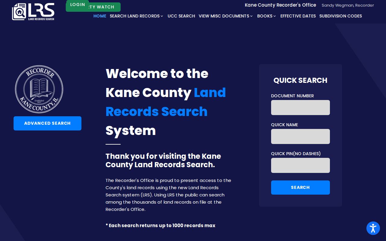
The index fields supply the citation needed before an older image or office copy is requested.
- Find the current parcel and copy its PIN, owner spelling, and legal description.
- Open the newest deed and record its grantor, grantee, instrument number, type, date, and book or image reference.
- Search the present grantee as a grantor in earlier years to find the prior transfer.
- Repeat the link, checking that each legal description still refers to the same land.
- When the web trail ends, ask about tract books, microfilm, office terminals, and copies by mail or in person.
- Grantor and grantee
- The grantor transfers an interest; the grantee receives it.
- Chain of title
- The linked series of recorded transfers for the same property.
- Legal description
- The lot, subdivision, or survey wording that identifies land more firmly than a street label.
A deed-index row is a pointer, not the complete instrument. The deed image may add signatures, trust or estate terms, covenants, and other facts absent from the index. Preserve both the index citation and the copy source so another researcher can repeat the work.
Three Numbers for One Elgin House
Old street numbers are the most distinct Elgin trap. The Gail Borden house-history handout documents renumbering in the 1870s, 1884, and 1894. The 1884 plan used Chicago Street, now West Chicago, and the Fox River as baselines. The 1894 revision changed that logic. One surviving building can therefore appear under three numbers.
Street names also shifted. Main became State, Dexter became National, Mill became Douglas, Railway became Wellington, and sections of River Street became Hendee or Grove. Search the museum's 1892 directory form with both current and old number and name fields. This is an insider shortcut designed for Elgin's own address history.
Create a small crosswalk before searching previous residents: current number, likely 1884 number, likely 1894 number, old street name, and modern street name. Never force two entries together solely because the house number matches.
Elgin Maps Separate Building History
Sanborn maps answer a different question from deeds and directories. The Elgin series includes 1887, 1891, 1897, 1903, 1913, and 1939. A sheet may show a structure's footprint, construction material, use, outbuildings, or changes between editions. It does not prove who occupied the rooms. Compare a Sanborn year with a deed transfer and a directory listing instead of treating the map as a resident roll.
The Elgin History Museum's Building Lookup adds street, construction year, original owner, and builder fields where known. The collection warns that it is incomplete. The successful project screenshot below shows the public entry point and the kind of building-based search that can extend an address trail.
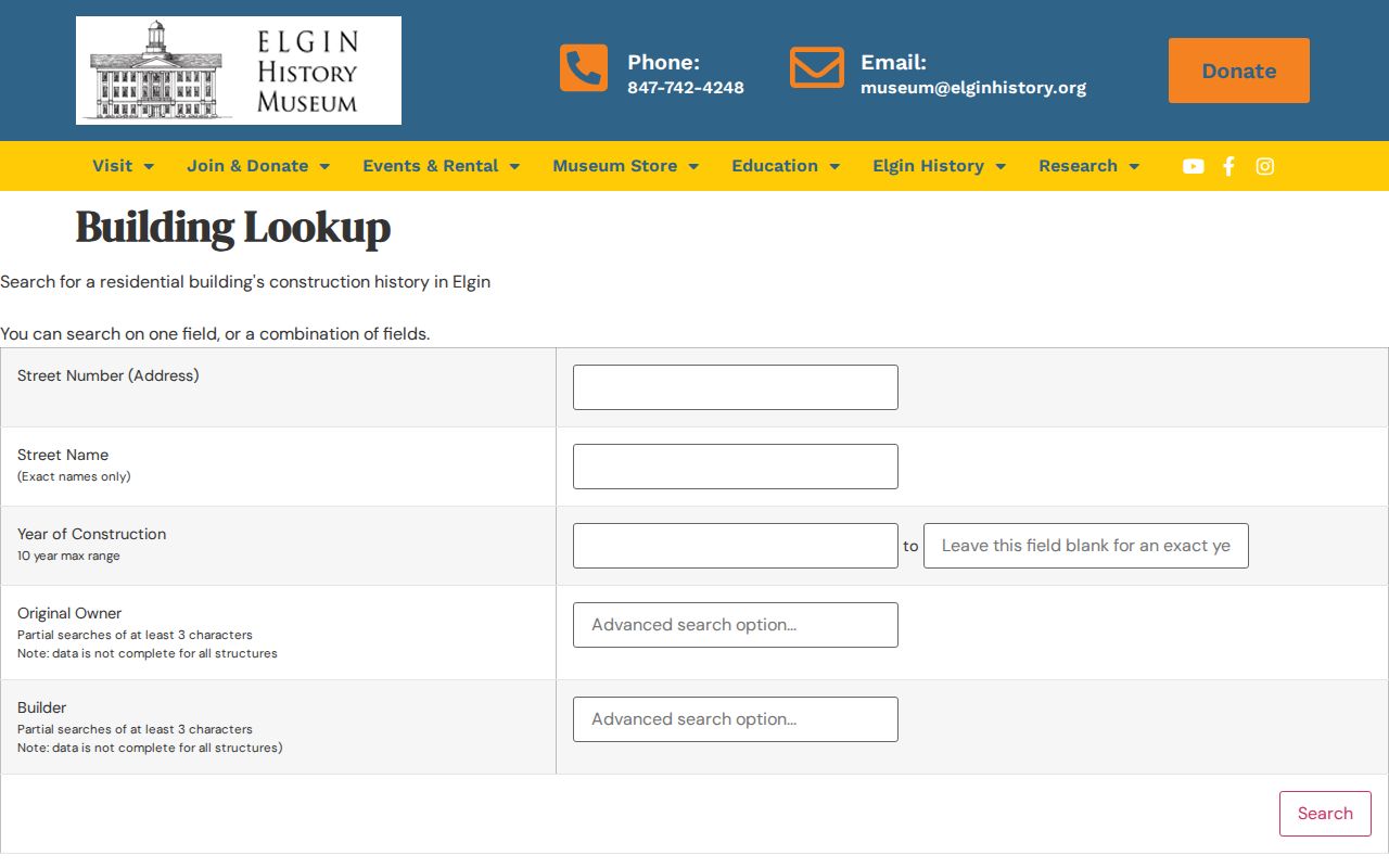
Use a building result as a dated lead, then confirm the land and owner through county records. A building may remain while the parcel around it changes.
Elgin Past Residents Beyond Owners
Owners are not always occupants. Historical Elgin directories can place a named householder, spouse, occupation, or business at an address in a given edition. Address indexing becomes more useful from about 1900. The full publisher runs and collection details belong to the Elgin city directories page; for address history, extract only the year, printed name, address form, and abbreviation notes needed for the chain.
Pair each directory year with the closest available census, newspaper, and map year. The sequence is simple: deed owner to directory occupant, directory address to Sanborn footprint, then name and date to an obituary, probate, funeral, or cemetery index. Gail Borden's genealogy room, the Elgin History Museum, and the Elgin Genealogical Society supply those fallback routes online, by appointment, by email, and in person.
Lawful use. Research previous residents for family history, property history, or civic curiosity. Never use a living person's address trail to watch, harass, or harm anyone.
Elgin Archives When Search Fails
Stop repeating the same web query when the address chain reaches a gap. Gail Borden offers second-floor genealogy resources, microfilm, local newspapers, maps, directories, and one-on-one research help. The Elgin History Museum offers volunteer house research with limits and a fee described by the local materials. The Elgin Genealogical Society indexes obituaries, probate, divorce, church, cemetery, and funeral records. Municipal permits may be requested from Elgin when they are not posted.
Kane's 1843 fire damaged records, and the March 1890 fire destroyed about 5,000 court files even though volumes survived. A missing early result can be a real archive gap. IRAD preserves other bridges, including Elgin council proceedings, Court of Common Pleas records, and death, burial, and removal permits. Record the channels checked: portal, recorder terminal, library shelf, archive request, museum service, mail, email, phone, and municipal FOIA.
The newest local-history lead is the Elgin Dairy Report for 1892 through 1903, digitized after a state grant announced in 2026. It can connect a directory business name to a narrow period of Elgin's dairy history, but it should remain one clue beside deeds and newspapers.
Note: Write “not found in the inspected source” until both the online index and the relevant Elgin archive channel have been checked.
Route Elgin Previous Residents by County
An Elgin mailing label does not identify the records office. Most parcels fall in Kane County, while the Cook County portion uses a different assessor, parcel viewer, recording division, circuit clerk, and vital-record custodian. Confirm the county on a parcel map before opening a deed chain. For Cook property, remember that the former Recorder of Deeds was consolidated into the Cook County Clerk in 2020, so the Clerk's recordings office now handles that archive.
The Cook recorded-documents page is the official Cook-side route.
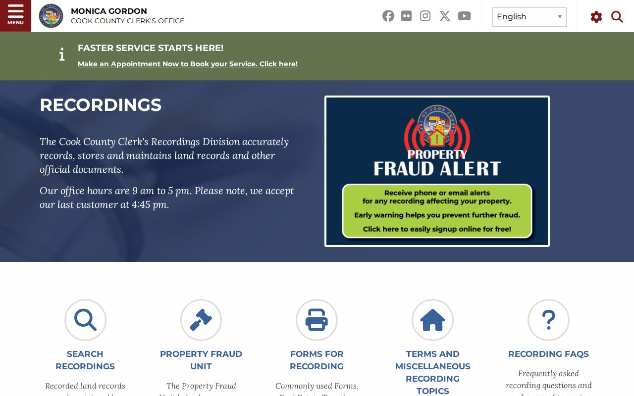
Its placement under the Clerk reflects the county's consolidated recording structure.
The county-of-event rule also matters after a name appears in the house trail. A death, marriage, probate file, or court case belongs with the county where the event or filing occurred, not always the county where the person once lived. Search both Elgin jurisdictions only when the evidence supports it. This keeps previous residents with common names from being merged into one false history.